Detouring through the +15 Skywalk
Have you ever had opportunity to visit a maze? Did you get lost? Were you overwhelmed? Why did you go in the first place: as a dare? for some group event? was it part of a tour?
Well, did you know that Calgary has it’s very own public maze? It’s called the +15 Skywalk and it’s accessible to any member of the willing public from early in the morning to late at night. Located in the heart of Calgary’s Downtown it forms an integral part of the lifeblood of the City Centre!

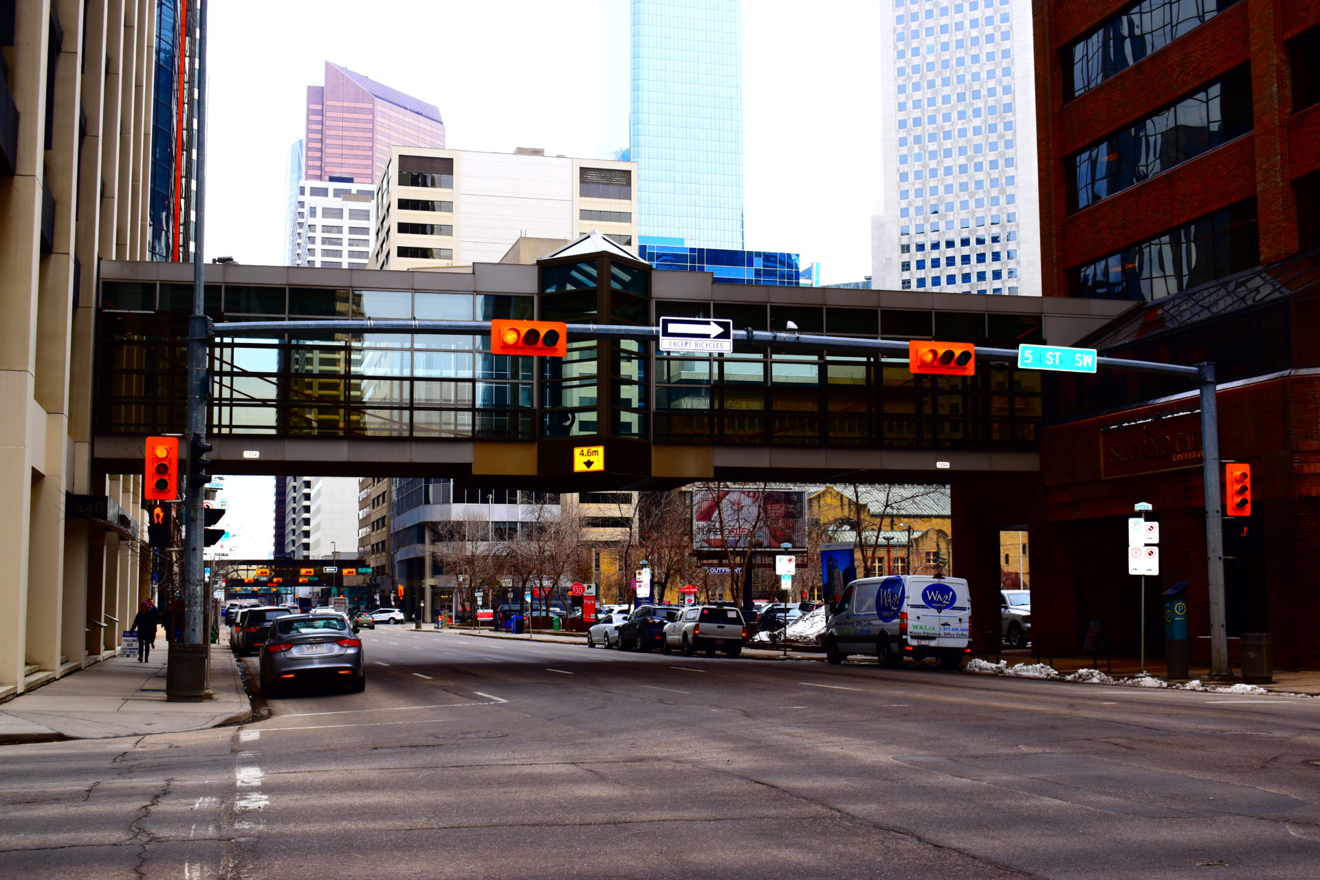
The +15 is a labyrinth of above-street walkways that link many of the key high-rises in the Downtown, enabling employees and visitors to navigate the City Centre in a weather-protected environment. This is especially helpful when the outdoor temperatures plummet to sub-zero, when there is a frigid north wind being funnelled down the streets, snow is being swept up seemingly from all directions, and one is having to avoid icy and slippery sidewalks or falling ice from building overhangs. It is these seasonal conditions that make the prospect of being confined to a maze somewhat more appealing! Besides, as it turns out, there is much to discover and explore in this above-street detour. However, be warned from the get-go: there is nothing direct or, dare I say logical, about the +15 routing! Don’t expect to enter it in one building and hope to find an easy route to your destination! I am hoping that I can help to demystify some of this maze for you before you venture forth into its network of passageways.
But first let me offer you some background.
Why “the +15”? It’s simple: the 15 represents the 15 feet that the second floor of most high-rise structures are located at. The arterial bridges that make up the skywalk usually link the 2nd floor of one skyscraper to another. The clearance from the bridge deck to the street below is generally at or just more than 15 feet, hence the reference to “the +15”.
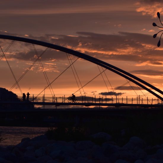
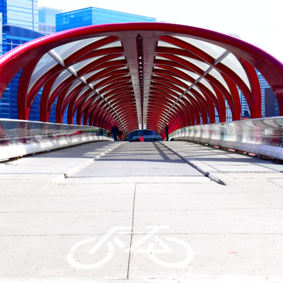
The first bridge was introduced to the City’s Downtown in 1970, crossing 4th Avenue SW between 2nd and 3rd Street. Today there are more than 62 bridges criss-crossing the Downtown street grid where a pedestrian can cover in excess of 18km navigating this concrete, steel and glass maze and, in all likelihood, not have to touch the street 15 feet below at all!
 |
|
+15 route markers confirming your location [DD] |
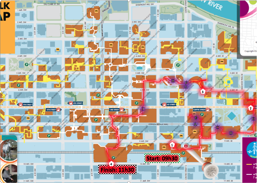
This last statement is not altogether true, as I discovered during a recent Friday morning when I had some free time and decided to set out and explore the +15. I accessed the Skywalk at the Calgary Tower at 150 9th Avenue SW, adjacent to the Fairmont Palliser Hotel at 09h30. My goal was to reach the City Centre Parkade on 10th Avenue SW a few blocks south and west. I had two hours to kill and was equipped with a camera and a backpack full of optimism and enthusiasm. The red highlight on the map below indicates the route I ended up taking and provides an indication of how much – or little? – ground I covered compared to the rest of the available extensive +15 walkways. On the aside, the brown shapes on this map depict the buildings connected by the Skywalk system. The yellow connecting walkways are open from 07h00 to 21h00 on weekdays. The white walkways are open daily from 07h00 until midnight.
 |
|
Interactive maps en route showing your location and compass orientation [DD] |
Overall I have to say that I was pleasantly surprised by the diversity I encountered. I’ve used the +15 quite extensively over the past few years. However, passing through it on a tourist-type mission opened my eyes afresh to some of the great features the Skywalk has to offer. From the well demarcated interactive maps and directions as you enter most buildings to the public art displays; from the availability of eating places to the bustle of corporate employees going about their normal daily routines. It was surprisingly energizing and well worth the exploration. Clearly 2 hours was insufficient to cover the entire maze, but I did manage to complete part of my goal which was to reach the City Centre Parkade exit on 10th Avenue by 11h30. Sadly I did fail at one aspect of my mission, though. Perhaps, more accurately stated, the Skywalk failed me! Below is a blown up version of the route that I took together with some highlights I encountered along the way.
My route commenced at (1) as shown on the map. I managed to navigate my way to point
(2) where I discovered that, due to construction work on some of the buildings, I was forced to exit to street level and resume my elevated exploration route at
(3), the Bow Building which is currently Calgary’s tallest skyscraper. I rejoined the rabbit warren of elevated bridge networks and managed to reach my destination at
(4) in time for 11h30.
Admittedly it does help that I know my bearings in the City. I did periodically choose to look out of a bridge window to briefly confirm that my orientation and direction were correct. Carrying a copy of the Skywalk map also aided my success. It’s unlikely that, as a newcomer to the City, you would choose to cover ground as speedily as I did. The point is that you should not underestimate the time it takes to cover the route nor how much there is to enjoy and explore along the the way.
This selection of photos, taken at the purple sun-burst icon locations shown on the map above, are just a small sample of what I saw and enjoyed, some of them for the first time ever. Locals and visitors alike will no doubt see a myriad of other things that I overlooked which is what makes discovering the Skywalk a worthwhile attraction and an explorer’s dream if you’re looking for a family-friendly or solitary traveller activity to do Downtown in all weather conditions!
 |
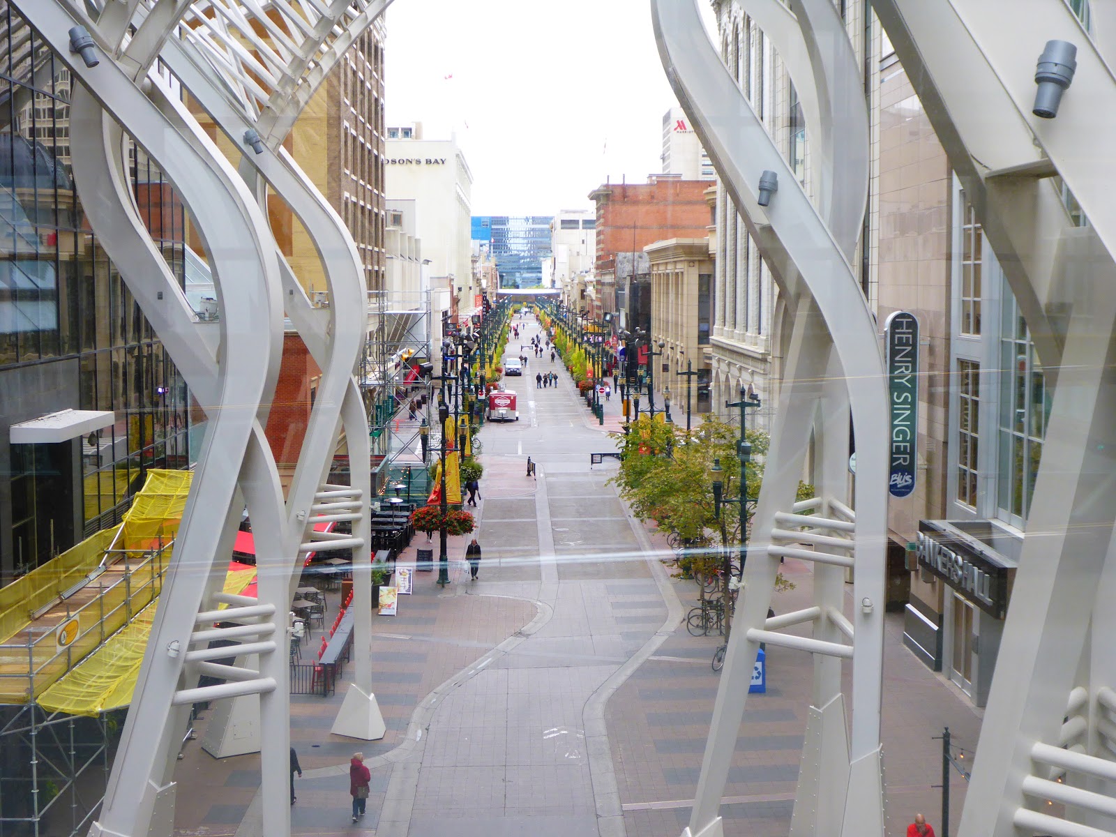
| A. Looking west along Stephen Avenue Walk (8th Av S) from the +15 [DD] |
 |
|
B. Murals in the Skywalk between the Hyatt Regency and the Convention Centre [DD] |
 |
|
C. Funky seating outside the Jack Singer Concert Hall [DD] |
 |
|
D. Bright Mural Artwork in the Arts Commons Area [DD] |

 |
|
E. The evolution of Calgary’s naming origin based on Calgary Bay on the Isle of Mull in Scotland. Artistic renditions of the City’s development are on display in the Municipal Building lobby near City Hall. [DD] |
 |
| F. The “Wonderland” stainless steel sculpture on the plaza in front of The Bow Building [DD] |
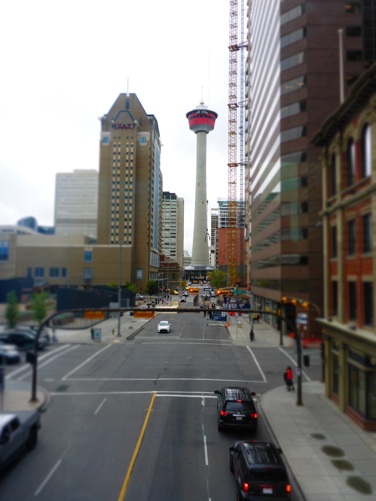 |
| G. A view looking south down Centre Street towards the Calgary Tower from a +15 bridge [DD] |
 |
| H. A historic Norseman V hanging from the ceiling of the Suncor Energy Building on 5th Ave SW [DD] |
 |
| I. The Calgary Tower appears as a dwarfed reflection in the windows of the recently completed Brookfield Place on 7th Av SW [DD] |
 |
| Nearing the end of my exploration, looking east along Stephen Avenue Walk towards one of the first +15 bridges that I crossed near the start of my journey. [DD] |
Having highlighted all of this I have to confess, though, that I would recommend detouring to and exploring the +15 in poor or colder weather. Our warm season in Calgary is so brief that you would do well to rather explore and enjoy life out on the street where there is so much to discover that will titillate your senses while the ambient temperatures are bearable.
Overview information about Calgary’s +15 Skywalk:
- Location: Calgary Downtown between 7th Street SW and 1st Street SE, and Riverfront Avenue S and 10th Avenue S
- How to get there:
- All LRT routes converge on the Downtown
- Any city-centre destined buses
- Private automobile: street parking is available for limited periods
- Bicycle: Downtown cycle paths enable access to the +15 linked buildings. Bicycle lock-up facilities are available at street level. You will need to provide your own lock.
- Access: Throughout the Downtown area from most skyscraper foyers connected to the +15
- Fees: no access fees required
- Open: varying from 7am to 9pm on work weekdays for some building and 7am to midnight every day for others
- Amenities: washrooms, eating facilities, all +15 routes are wheelchair accessible